» SOFTWARE » PREVISIONAL HIGH FREQUENCY » EMLAB-EVOLUTION
 |
GET YOUR QUOTE
Main Category:
SOFTWARE
Secondary Category:
PREVISIONAL HIGH FREQUENCY
Status:
AVAILABLE
Brand:
ALDENA
Model Name:
EMLAB-EVOLUTION
Item Code:
ALDENA EMLAB-EVOLUTION DB
Applications:
Environmental measures EMF RF
Description:
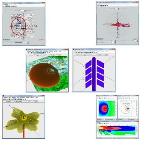
Professional software for the design or the reconstruction of an antenna system. Allows a more detailed analysis of the solid radiation source with the same transmitter generated an indefinite number of elementary antennas System (Radiant). The solid is analyzed in three-dimensional maps or superimposed on the reconstruction of the geographical territory (DTM - Digital Terrain Model). ì. In addition to maps and geo-referenced user choices, the polar plots (conic sections) horizontal masks can also be superimposed reference and information about the location of the service area. The program helps the user to calculate the phase shift between antennas, which are necessary to obtain electrical tilt, fills the first zero, zero protection.
General Features:
Calculate the value of the environmental impact of the test system. The radiated field near the antenna is scanned for horizontal or vertical flat sections, comparable to maps or drawings and iso-level curves to be represented or colored areas with level values and user-definable colors.
MORE INFORMATION